흑해는 강에서 끊임 없이 담수를 공급받아 보다 염도가 낮고 에게해는 그에 비해 염도가 높기 때문에 밀도 차이에 의해 표층에서는 산소가 풍부하고 염도가 낮은 해수가 흑해에서 에게해로 흐르고 심층에서는 산소가 거의 없는 염도가 큰 해수가 에게해에서 흑해로 흘러든다. 전체적으로 보아 흑해의 물수지는 유입량보다 유출량이 더 크며 해마다 300 km3 가량의 물이 보스포루스 해협과 다르다넬스 해협을 통해 에게해로 흘러 들어간다.[6]
흑해의 해수면은 지질학적 시기에 따라 크게 변화되었다. 최종빙기 시기 해수면이 낮아졌을 때는 지금의 대륙붕 대부분이 육지였고 발칸반도와 아나톨리아 역시 이어져 있었다. 이 시기 흑해는 오늘날 카스피해와 같이 내륙 깊숙이 자리한 호수였다. 최종빙기가 끝나고 간빙기가 시작되자 해수면이 상승하게 되었고 대략 7천년 전 무렵 지중해와 연결되어 오늘날과 같은 바다가 되었다. 그러나 둘을 연결하는 보스포루스 해협은 여전히 좁고 얕은 물길이어서 깊이는 36 - 120 m 정도이고 가장 좁은 곳의 폭은 750 m 에 불과하다. 다르다넬스 해협 역시 좁은 곳의 폭이 1 km 정도이다. 이런 면에서 볼 때 흑해는 간신히 해양과 연결되어 있는 내해라 할 수 있다.
"검은 바다"라는 이름은 13세기 무렵에 등장하였고 그 이전에는 보이지 않는다.[8] 이 바다를 부른 가장 오랜 이름 가운데 하나는 아나톨리아에서 청동기 문화를 일구었던 하티인이 붙인 잘파해이다.[9]히타이트는 이들을 점령하면서 잘파해라는 명칭을 이어받았다. 잘파는 아나톨리아 북부 흑해 연안에 있던 하티인들의 중심지였으며 오늘날 키질이르마크강인 마라산티아강 하구에 있었다.[10]
고대 그리스에서는 그리스어: Εύξεινος Πόντος /ˈefksinos ˈpondos/, 에프크시노스 폰도스[*]라 불렀는데 "쾌적한 바다"라는 의미이다.[11] 한편 고대 페르시아어는 "검푸른"을 의미하는 악사니아(axšaina)로 불렸고 이것이 그리스에 와전되어 전해져 "잔혹한 바다"라는 의미의 폰투스 악시노스(Pontus Axīnus)로 알려졌다가 훗날 이와 반대되는 이름인 "쾌적한 바다"로 이름을 바꾸었다는 설명이 있다.[12] 바다의 명칭을 이렇게 바꾼 것은 기원전 5세기 무렵 핀다로스였다고 한다. 그러나 고대 로마 시기까지도 여전히 악시노스라는 명칭이 함께 사용되었다.[8] 고대 그리스어에서 유래한 "Euxine"(영어의 경우 /júːksain/, 유크사인)은 오늘날에도 흑해의 다른 명칭으로 사용된다.[11]
스트라본의 《지리학》에서는 종종 흑해를 그저 "바다"라고 서술한다. 아마도 당시 그리스인들에게 대표적인 바다는 흑해였기 때문일 것이다.[13] 풍랑이 거칠어 항해가 힘들었기 때문에 스트라본은 흑해의 참된 이름을 잔혹한 바다인 "폰투스 악스노스"로 여겼고, 쾌적한 바라라는 말은 먼훗날 마치 최악의 상황에서 발견한 곳에 희망봉이라는 이름을 붙인 것과 같이 뱃사람들의 바램을 담은 반의적 표현으로 보았다.[14]
중세 페르시아의 조로아스터교 신학자였던 분다히신은 흑해를 시야분(Siyābun)이라 불렀고[15] 10 세기 페르시아 지리학 서적《세계의 경계》(아랍어: حدود العالم 후두드 알 알람[*])에서는 "구르즈(조지아)의 바다"로 불렀다.[16] 한편 《조지아 연대기》에서는 캅카스에 살던 고대 부족의 이름을 따 사스페이의 바다라 기록하고 있다.[17]
이 바다를 "검은 바다"로 부르게 된 것은 튀르키예어에서 북쪽을 "검다"고 표현하는 관습에서 유래하였다. 오스만 제국의 중심지였던 아나톨리아를 기준으로 할 때 흑해는 북쪽에 위치해 있기 때문이다. 오스만 제국은 한 때 흑해 연안의 거의 대부분을 지배하였기 때문에 이 시기 튀르키예의 명칭도 여러 언어에 전파되었을 것이다. 또한 튀르키예어에서 "검은"은 크다는 의미로도 사용되어 "검은 바다"는 큰 바다라는 의미가 되기도 한다.[18] 방위와 색상을 결합하는 것은 아시아에 넓게 퍼진 문화로 동아시아의 오방색역시 같은 조합을 보인다. 동쪽은 녹색이나 밝은 청색, 흰색은 서쪽, 붉은 색은 남쪽, 그리고 검은색은 북쪽을 의미한다. 이에 따르면 홍해 역시 남쪽의 바다란 의미로 붙여진 이름이다.[8] 13세기 이후 등장한 흑해라는 이름은 이후 이 바다를 부르는 일반적 명칭이 되었다.[8] 1570년 무렵 플랑드르의 지도제작자 아브라함 오르텔리우스가 제작한 지도 《새롭게 묘사한 아시아》(Asiae Nova Descriptio)에는 "큰 바다"라는 의미의 라틴어: Mar Maggior 마르 마기오르[*]란 이름이 표기되어 있다.[19] 18세기 무렵 영어에서는 흑해와 함께 고대 그리스어에서 유래한 유사인해(Euxine Sea)라는 표현이 함께 쓰였다.[20]
흑해 지역 기후에 영향을 주는 요인으로는 북대서양 진동이 있다.[32] 북대서양 진동이 정확히 어떤 경로를 거쳐 북해 지역 기후에 영향을 주는 지는 명확히 알려져 있지 않지만[33] 동유럽에서 북해 일대 및 아시아에 이르기까지 겨울철 폭풍 발생과 연관되어 있다.[34] 북대서양 진동은 흑해뿐만 아니라 지중해 전반의 해수면 온도에도 영향을 미친다.[35]
흑해는 대륙에 둘러쌓인 중위도 바다로 인근 육지의 기후에 큰 영향을 받는다. 불가리아와 우크라이나, 러시아에 걸친 북서쪽은 동유럽평원과 같이 겨울에 춥고 여름이 덥고 건조한 스텝기후를 보이며, 튀르키예와 조지아에 걸친 동남쪽의 일부는 캅카스산맥이 기류에 영향을 주어 고온다습한 아열대 기후와 지중해성 기후를 보이기도 한다.[36] 흑해 역시 지구온난화에 따른 기후 변화로 해수면 온도가 상승하는 중이다.[37]
흑해는 안드루소프 융기를 비롯한 중부 해저융기부를 기준으로 동부와 서부로 세분된다. 안드루소프 융기를 비롯한 해저융기부는 백악기 중기인 알비절 시기 형성된 화산호(火山弧)와 중생대 시기 테티스해의 형성과 해체 과정 전후로 일어난 판들의 섭입을 통해 형성된 것으로 크림반도 남단에서 시작하여 비스듬히 남동쪽을 향해 놓여 있다. 당시 이 지역은 로라시아의 해안이었을 것이다. 과거 지진 활동에 대한 연구 결과 흑해 중부 해저융기부는 백악기 전기인 바렘절에서 압트절 무렵 융기하기 시작하여 이후 2천만 년 뒤인 산토눔절까지 융기가 지속되었다.[38][39][40] 이 시기 동안 지각에 가해진 압력으로 해저분지의 침하, 광범위한 규모의 화산 분출, 그리고 여러 차례의 조산 운동이 함께 일어나 볼쇼이캅카스산맥, 폰투스산맥 등의 융기와 함께 발칸반도와 크림반도의 산지가 형성되었다.[41]
이와 같은 장기적인 판구조 운동으로 흑해는 대부분의 지역이 육지로 둘러쌓이게 되었고 북서부는 해안에서 190 km에 이르는 대륙붕이 발달하며 완만한 경사를 이루는 얕은 바다를 이루는 반면 동남부의 아나톨리아와 조지아 연안은 매우 가파르며 대륙붕이 거의 발달하지 않은 모습을 보인다. 흑해에서 가장 깊은 곳은 크림반도의 얄타에서 남쪽에 있는 유크사인 심해저 평원으로 최대 수심은 2,212 m 이다.[44]
해양 산소 동위원소 단계(marine isotope stages, MIS) 분석에 의한 흑해의 고대 해수면은 대략 MIS 6, 8, 10 시기에 가장 낮았고, 최종 간빙기인 MIS 5e 무렵 가장 높았다. 가장 해수면이 높았던 시기는 아마도 플라이스토세 말기였을 것이다. 이 시기 크림반도는 바다로 분리된 섬이었을 수 있다.[45]
흑해 해저에 형성된 사암 퇴적층은 한 때 카피스해와 하나의 수계를 이루었던 흑해가 세 단계의 변화를 거치며 현재의 모습으로 자리잡았다는 것을 보여준다. 흑해의 해수면이 낮아 다른 해역과 분리된 상태에서 흑해보다 20 m 가량 높은 곳에 위치한 카피스해의 물이 흘러들면서 바닥에 모래가 쌓였다. 이들 모래는 얕은 바닥에 쌓여 패각석을 형성하였다. 보다 깊은 곳에서는 소금이 함유된 사암에서 연체동물 화석이 발견되며, 가장 낮은 해수면을 형성하였던 사암층에서는 육지에서 유래한 모래들이 강을 따라 흘러들어 퇴적된 충적층에서 유래한 사암층이 발견된다.[46]
최종빙기 시기 흑해의 해수면은 지금보다 약 70 m 정도 낮아 완전히 외부와 고립된 내해였다.[47] 최종빙기가 끝나면서 해수면은 점차 상승하였고 대략 7천년 전 무렵 에게해와 연결되었을 것이다.[48] 한편 1997년 윌리엄 리언 등은 약 5천 6백년 전 한참 해수면이 낮았던 흑해로 한참 해수면이 상승하던 에게해 등지에서 한꺼번에 물이 쏟아져 들어왔을 것이라는 흑해 대홍수 가설을 주장하였다. 당시 흑해의 저지대 연안에는 분명 선사시대의 인간들이 거주하고 있었을 것이므로 이것이 훗날 여러 신화에서 발견되는 대홍수 신화의 기원일 수 있다는 주장이었다.[49][50] 그러나 흑해가 갑자기 물에 잠겼다는 과학적 증거는 없다. 흑해는 빙기와 간빙기를 오가는 기후에 따라 여러 차례 에게해와 연결되고 분리되기를 반복하였고[51] 현재의 마지막 합류 시기도 추정일 뿐이어서 그 보다 오래 전인 1만 5천년 무렵 이미 에게해와 맞닿았다는 분석도 있다.[52] 윌리엄 리언 등의 주장은 한 가지 사실에 대해 과도한 의미를 부여한 것으로 비판된다. 아마도 성서 등에 기록된 노아의 홍수를 염두에 둔 선입견이 작용하였을 것이다. 2011년 다수의 고고학자들은 흑해 해저에서 어떠한 선사 유적도 발견되지 않고 있다고 밝혔다.[53]
흑해는 세계에서 가장 큰 부분순환호이다.[54] 해저 깊은 곳의 물은 거의 다른 곳의 것과 섞이지 않은 채 고여있고 산소 순환은 대기와 교환되는 것 말고는 없어서 흑해의 해수 90% 가량이 산소가 없는 상태이다.[55] 흑해의 해류는 강 어귀에서 유입되는 민물이 경사를 따라 흘러들다 표면으로 이동하는 수직적 흐름을 보인다.
흑해는 보스포루스 해협과 다르다넬스 해협을 통해 마르마라해와 해수 교환이 이루어지지만, 그 양은 크지 않다. 흑해에서 유출되는 해수는 연간 16000 km3 정도이고 마르마라해에서 유입되는 해수는 연간 11000 km3 정도여서 유출량이 약간 더 많다.[56] 2010년 리즈 대학교의 연구팀이 보스포로스 해협의 해저 밑에서 마치 강물처럼 에게해에서 흑해로 흘러드는 해류를 발견하였다. 이는 담수 유입이 많은 흑해보다 에게해의 염도가 더 높기 때문에 일어나는 현상이다.[57] 따라서 표층 해류는 흑해에서 마르마라해를 거쳐 에게해로 흐르고 심층 해류는 거꾸로 에게해에서 흑해로 흘러들지만 유량은 표층이 더 크다고 할 수 있다.
중심부의 표층 해류는 지구 자전의 영향을 받아 반시계 방향으로 흐르며 최대 50–100 cm/s (20–39 in/s) 정도의 속도를 보인다.[58] 표층 해류의 흐름은 여름철에는 뚜렷한 경향성을 보이지만 겨울철에는 날씨의 영향이 커져 뚜렷하지 않다. 연안에서는 바람의 영향을 더 크게 받는다.[59]
Because of the anoxic water at depth, organic matter, including anthropogenic artifacts such as boat hulls, are well preserved. During periods of high surface productivity, short-lived algal blooms form organic rich layers known as sapropels. Scientists have reported an annual phytoplankton bloom that can be seen in many NASA images of the region.[60] As a result of these characteristics the Black Sea has gained interest from the field of marine archaeology, as ancient shipwrecks in excellent states of preservation have been discovered, such as the Byzantine wreck Sinop D, located in the anoxic layer off the coast of Sinop, Turkey.
Modelling shows that, in the event of an asteroid impact on the Black Sea, the release of hydrogen sulfide clouds would pose a threat to health—and perhaps even life—for people living on the Black Sea coast.[61]
There have been isolated reports of flares on the Black Sea occurring during thunderstorms, possibly caused by lightning igniting combustible gas seeping up from the sea depths.[62]
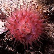
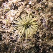
The Black Sea supports an active and dynamic marine ecosystem, dominated by species suited to the brackish, nutrient-rich, conditions. As with all marine food webs, the Black Sea features a range of trophic groups, with autotrophic algae, including diatoms and dinoflagellates, acting as primary producers. The fluvial systems draining Eurasia and central Europe introduce large volumes of sediment and dissolved nutrients into the Black Sea, but the distribution of these nutrients is controlled by the degree of physiochemical stratification, which is, in turn, dictated by seasonal physiographic development.[63]
During winter, strong wind promotes convective overturning and upwelling of nutrients, while high summer temperatures result in a marked vertical stratification and a warm, shallow mixed layer.[64] Day length and insolation intensity also control the extent of the photic zone. Subsurface productivity is limited by nutrient availability, as the anoxic bottom waters act as a sink for reduced nitrate, in the form of ammonia. The benthic zone also plays an important role in Black Sea nutrient cycling, as chemosynthetic organisms and anoxic geochemical pathways recycle nutrients which can be upwelled to the photic zone, enhancing productivity.[65]
In total, the Black Sea's biodiversity contains around one-third of the Mediterranean's and is experiencing natural and artificial invasions or "Mediterranizations".[66][67]
Phytoplankton blooms and plumes of sediment form the bright blue swirls that ring the Black Sea in this 2004 image.
The main phytoplankton groups present in the Black Sea are dinoflagellates, diatoms, coccolithophores and cyanobacteria. Generally, the annual cycle of phytoplankton development comprises significant diatom and dinoflagellate-dominated spring production, followed by a weaker mixed assemblage of community development below the seasonal thermocline during summer months, and surface-intensified autumn production.[64][68] This pattern of productivity is augmented by an Emiliania huxleyi bloom during the late spring and summer months.
Annual dinoflagellate distribution is defined by an extended bloom period in subsurface waters during the late spring and summer. In November, subsurface plankton production is combined with surface production, due to vertical mixing of water masses and nutrients such as nitrite.[63] The major bloom-forming dinoflagellate species in the Black Sea is Gymnodinium sp.[69] Estimates of dinoflagellate diversity in the Black Sea range from 193[70] to 267 species.[71] This level of species richness is relatively low in comparison to the Mediterranean Sea, which is attributable to the brackish conditions, low water transparency and presence of anoxic bottom waters. It is also possible that the low winter temperatures below 4 °C (39 °F) of the Black Sea prevent thermophilous species from becoming established. The relatively high organic matter content of Black Sea surface water favor the development of heterotrophic (an organism that uses organic carbon for growth) and mixotrophic dinoflagellates species (able to exploit different trophic pathways), relative to autotrophs. Despite its unique hydrographic setting, there are no confirmed endemic dinoflagellate species in the Black Sea.[71]
The Black Sea is populated by many species of the marine diatom, which commonly exist as colonies of unicellular, non-motile auto- and heterotrophic algae. The life-cycle of most diatoms can be described as 'boom and bust' and the Black Sea is no exception, with diatom blooms occurring in surface waters throughout the year, most reliably during March.[63] In simple terms, the phase of rapid population growth in diatoms is caused by the in-wash of silicon-bearing terrestrial sediments, and when the supply of silicon is exhausted, the diatoms begin to sink out of the photic zone and produce resting cysts. Additional factors such as predation by zooplankton and ammonium-based regenerated production also have a role to play in the annual diatom cycle.[63][64] Typically, Proboscia alata blooms during spring and Pseudosolenia calcar-avis blooms during the autumn.[69]
Coccolithophores are a type of motile, autotrophicphytoplankton that produce CaCO3 plates, known as coccoliths, as part of their life cycle. In the Black Sea, the main period of coccolithophore growth occurs after the bulk of the dinoflagellate growth has taken place. In May, the dinoflagellates move below the seasonal thermocline into deeper waters, where more nutrients are available. This permits coccolithophores to utilize the nutrients in the upper waters, and by the end of May, with favorable light and temperature conditions, growth rates reach their highest. The major bloom-forming species is Emiliania huxleyi, which is also responsible for the release of dimethyl sulfide into the atmosphere. Overall, coccolithophore diversity is low in the Black Sea, and although recent sediments are dominated by E. huxleyi and Braarudosphaera bigelowii, Holocene sediments have been shown to also contain Helicopondosphaera and Discolithina species.
Cyanobacteria are a phylum of picoplanktonic (plankton ranging in size from 0.2 to 2.0 μm) bacteria that obtain their energy via photosynthesis, and are present throughout the world's oceans. They exhibit a range of morphologies, including filamentous colonies and biofilms. In the Black Sea, several species are present, and as an example, Synechococcus spp. can be found throughout the photic zone, although concentration decreases with increasing depth. Other factors which exert an influence on distribution include nutrient availability, predation, and salinity.[72]
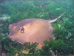
The Black Sea along with the Caspian Sea is part of the zebra mussel's native range. The mussel has been accidentally introduced around the world and become an invasive species where it has been introduced.
The common carp's native range extends to the Black Sea along with the Caspian Sea and Aral Sea. Like the zebra mussel, the common carp is an invasive species when introduced to other habitats.
Another native fish that is also found in the Caspian Sea. It preys upon zebra mussels. Like the mussels and common carp, it has become invasive when introduced to other environments, like the Great Lakes in North America.
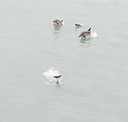
Marine mammals present within the basin include two species of dolphin (common[73] and bottlenose[74]) and the harbour porpoise,[75] although all of these are endangered due to pressures and impacts by human activities. All three species have been classified as distinct subspecies from those in the Mediterranean and the Atlantic and are endemic to the Black and Azov seas, and are more active during nights in the Turkish Straits.[76] However, construction of the Crimean Bridge has caused increases in nutrients and planktons in the waters, attracting large numbers of fish and more than 1,000 bottlenose dolphins.[77] However, others claim that construction may cause devastating damages on the ecosystem, including dolphins.[78]
Ongoing Mediterranizations may or may not boost cetacean diversity in the Turkish Straits[76] and hence in the Black and Azov basins.
Various species of pinnipeds, sea otter, and beluga whale[82][83] were introduced into the Black Sea by mankind and later escaped either by accidental or purported causes. Of these, grey seals[84] and beluga whales[82] have been recorded with successful, long-term occurrences.
Great white sharks are known to reach into the Sea of Marmara and Bosporus Strait and basking sharks into the Dardanelles, although it is unclear whether or not these sharks may reach into the Black and Azov basins.[85][86]
Since the 1960s, rapid industrial expansion along the Black Sea coastline and the construction of a major dam has significantly increased annual variability in the N:P:Si ratio in the basin. In coastal areas, the biological effect of these changes has been an increase in the frequency of monospecific phytoplankton blooms, with diatom bloom frequency increasing by a factor of 2.5 and non-diatom bloom frequency increasing by a factor of 6. The non-diatoms, such as the prymnesiophytes Emiliania huxleyi (coccolithophore), Chromulina sp., and the Euglenophyte Eutreptia lanowii, are able to out-compete diatom species because of the limited availability of silicon, a necessary constituent of diatom frustules.[87] As a consequence of these blooms, benthic macrophyte populations were deprived of light, while anoxia caused mass mortality in marine animals.[88][89]
The decline in macrophytes was further compounded by overfishing during the 1970s, while the invasive ctenophore Mnemiopsis reduced the biomass of copepods and other zooplankton in the late 1980s. Additionally, an alien species—the warty comb jelly (Mnemiopsis leidyi)—was able to establish itself in the basin, exploding from a few individuals to an estimated biomass of one billion metric tons.[90] The change in species composition in Black Sea waters also has consequences for hydrochemistry, as calcium-producing coccolithophores influence salinity and pH, although these ramifications have yet to be fully quantified. In central Black Sea waters, silicon levels were also significantly reduced, due to a decrease in the flux of silicon associated with advection across isopycnal surfaces. This phenomenon demonstrates the potential for localized alterations in Black Sea nutrient input to have basin-wide effects.
Pollution reduction and regulation efforts have led to a partial recovery of the Black Sea ecosystem during the 1990s, and an EU monitoring exercise, 'EROS21', revealed decreased nitrogen and phosphorus values, relative to the 1989 peak.[91] Recently, scientists have noted signs of ecological recovery, in part due to the construction of new sewage treatment plants in Slovakia, Hungary, Romania, and Bulgaria in connection with membership in the European Union. Mnemiopsis leidyi populations have been checked with the arrival of another alien species which feeds on them.[92]
The Black Sea is connected to the World Ocean by a chain of two shallow straits, the Dardanelles and the Bosporus. The Dardanelles is 55 m (180 ft) deep, and the Bosporus is as shallow as 36 m (118 ft). By comparison, at the height of the last ice age, sea levels were more than 100 m (330 ft) lower than they are now.
There is evidence that water levels in the Black Sea were considerably lower at some point during the post-glacial period. Some researchers theorize that the Black Sea had been a landlocked freshwater lake (at least in upper layers) during the last glaciation and for some time after.
In the aftermath of the last glacial period, water levels in the Black Sea and the Aegean Sea rose independently until they were high enough to exchange water. The exact timeline of this development is still subject to debate. One possibility is that the Black Sea filled first, with excess freshwater flowing over the Bosporus sill and eventually into the Mediterranean Sea. There are also catastrophic scenarios, such as the "Black Sea deluge hypothesis" put forward by William Ryan, Walter Pitman and Petko Dimitrov.
The Black Sea deluge is a hypothesized catastrophic rise in the level of the Black Sea c. 5600 BC due to waters from the Mediterranean Sea breaching a sill in the Bosporus Strait. The hypothesis was headlined when The New York Times published it in December 1996, shortly before it was published in an academic journal.[93] While it is agreed that the sequence of events described did occur, there is debate over the suddenness, dating, and magnitude of the events. Relevant to the hypothesis is that its description has led some to connect this catastrophe with prehistoric flood myths.[94][95]
A 16th-century map of the Black Sea by Diogo HomemGreek colonies (8th–3rd century BCE) of the Black Sea (Euxine, or "hospitable" sea)
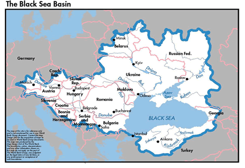
The Black Sea was a busy waterway on the crossroads of the ancient world: the Balkans to the west, the Eurasian steppes to the north, the Caucasus and Central Asia to the east, Asia Minor and Mesopotamia to the south, and Greece to the southwest.
The land at the eastern end of the Black Sea, Colchis (in present-day Georgia), marked for the ancient Greeks the edge of the known world.
Greek presence in the Black Sea began at least as early as the 9th century BC with colonies scattered along the Black Sea's southern coast, attracting traders and colonists due to the grain grown in the Black Sea hinterland.[100][{{{설명}}}][101]
By 500 BC, permanent Greek communities existed all around the Black Sea, and a lucrative trade-network connected the entirety of the Black Sea to the wider Mediterranean. While Greek colonies generally maintained very close cultural ties to their founding polis, Greek colonies in the Black Sea began to develop their own Black Sea Greek culture, known today as Pontic. The coastal communities of Black Sea Greeks remained a prominent part of the Greek world for centuries,[102][쪽 번호 필요] and the realms of Mithridates of Pontus, Rome and Constantinople spanned the Black Sea to include Crimean territories.
The Crimean War, fought between 1853 and 1856, saw naval engagements between the French and British allies and the forces of Nicholas I of Russia. On the 2 March 1855 death of Nicholas I, Alexander II became Tsar. On 15 January 1856, the new tsar took Russia out of the war on the very unfavourable terms of the Treaty of Paris (1856), which included the loss of a naval fleet on the Black Sea, and the provision that the Black Sea was to be a demilitarized zone similar to a contemporaneous region of the Baltic Sea.
틀:Campaignbox Black Sea naval campaign of World War I
The Black Sea was a significant naval theatre of World War I (1914–1918) and saw both naval and land battles between 1941 and 1945 during World War II. For example, Sevastopol was obliterated by the Nazis, who even brought Schwerer Gustav to the Siege of Sevastopol (1941–1942). The Soviet naval base was one of the strongest fortifications in the world. Its site, on a deeply eroded, bare limestone promontory at the southwestern tip of the Crimea, made an approach by land forces exceedingly difficult. The high-level cliffs overlooking Severnaya Bay protected the anchorage, making an amphibious landing just as dangerous. The Soviet Navy had built upon these natural defenses by modernizing the port and installing heavy coastal batteries consisting of 180mm and 305mm re-purposed battleship guns which were capable of firing inland as well as out to sea. The artillery emplacements were protected by reinforced concrete fortifications and 9.8-inch thick armored turrets.
As early as 29 April 2022 submarines of the Black Sea Fleet were used by Russia to bombard Ukrainian cities with KalibrSLCMs.[113][114] The Kalibr missile was so successful that on 10 March 2023 Defense Minister Sergey Shoigu announced plans to broaden the type of ship which carried it, to include the corvetteSteregushchiy and the nuclear-powered cruiser Admiral Nakhimov.[115]
On the morning of 14 March 2023, a Russian Su-27 fighter jet intercepted and damaged an American MQ-9 Reaper drone, causing the latter to crash into the Black Sea. At 13:20 on 5 May 2023 a Russian Su-35 fighter jet intercepted and threatened the safety of a Polish L-140 Turbolet on a "routine Frontex patrol mission.. and performed 'aggressive and dangerous' manoeuvres".[116] The incident, which occurred "in international airspace over the Black Sea about 60km" east of Romanian airspace,[117] "caused the crew of five Polish border guards to lose control of the plane and lose altitude."[118]
Yalta, CrimeaAmasra, Turkey, is located on a small island in the Black Sea.
The Black Sea plays an integral part in the connection between Asia and Europe.[119] In addition to sea ports and fishing, key activities include hydrocarbons exploration for oil and natural gas, and tourism.
According to NATO, the Black Sea is a strategic corridor that provides smuggling channels for moving legal and illegal goods including drugs, radioactive materials, and counterfeit goods that can be used to finance terrorism.[120]
The Turkish commercial fishing fleet catches around 300,000 tons of anchovies per year. The fishery is carried out mainly in winter, and the highest portion of the stock is caught between November and December.[122]
In the 1980s, the Soviet Union started offshore drilling for petroleum in the sea's western portion (adjoining Ukraine's coast). Independent Ukraine continued and intensified that effort within its exclusive economic zone, inviting major international oil companies for exploration. Discovery of the new, massive oilfields in the area stimulated an influx of foreign investments. It also provoked a short-term peaceful territorial dispute with Romania which was resolved in 2011 by an international court redefining the exclusive economic zones between the two countries.
The Black Sea contains oil and natural gas resources but exploration in the sea is incomplete. 2017년 기준[update], 20 wells are in place. Throughout much of its existence, the Black Sea has had significant oil and gas-forming potential because of significant inflows of sediment and nutrient-rich waters. However, this varies geographically. For example, prospects are poorer off the coast of Bulgaria because of the large influx of sediment from the Danube which obscured sunlight and diluted organic-rich sediments. Many of the discoveries to date have taken place offshore of Romania in the Western Black Sea and only a few discoveries have been made in the Eastern Black Sea.
During the Eocene, the Paratethys Sea was partially isolated and sea levels fell. During this time sand shed off the rising Balkanide, Pontide and Caucasus mountains trapped organic material in the Maykop Suite of rocks through the Oligocene and early Miocene. Natural gas appears in rocks deposited in the Miocene and Pliocene by the paleo-Dnieper and paleo-Dniester rivers, or in deep-water Oligocene-age rocks. Serious exploration began in 1999 with two deep-water wells, Limanköy-1 and Limanköy-2, drilled in Turkish waters. Next, the HPX (Hopa)-1 deepwater well targeted late Miocene sandstone units in Achara-Trialet fold belt (also known as the Gurian fold belt) along the Georgia-Turkey maritime border. Although geologists inferred that these rocks might have hydrocarbons that migrated from the Maykop Suite, the well was unsuccessful. No more drilling happened for five years after the HPX-1 well. In 2010, Sinop-1 targeted carbonate reservoirs potentially charged from the nearby Maykop Suite on the Andrusov Ridge, but the well-struck only Cretaceous volcanic rocks. Yassihöyük-1 encountered similar problems.
Other Turkish wells, Sürmene-1 and Sile-1 drilled in the Eastern Black Sea in 2011 and 2015 respectively tested four-way closures above Cretaceous volcanoes, with no results in either case. A different Turkish well, Kastamonu-1 drilled in 2011 did successfully find thermogenic gas in Pliocene and Miocene shale-cored anticlines in the Western Black Sea. A year later in 2012, Romania drilled Domino-1 which struck gas prompting the drilling of other wells in the Neptun Deep. In 2016, the Bulgarian well Polshkov-1 targeted Maykop Suite sandstones in the Polshkov High and Russia is in the process of drilling Jurassic carbonates on the Shatsky Ridge as of 2018.[123]
In August 2020, Turkey found 320십억 세제곱미터 (11조 세제곱피트) of natural gas in the biggest ever discovery in the Black Sea, and hoped to begin production in the Sakarya Gas Field by 2023. The sector is near where Romania has also found gas reserves.[124]
In the years following the end of the Cold War, the popularity of the Black Sea as a tourist destination steadily increased. Tourism at Black Sea resorts became one of the region's growth industries.[128]
The following is a list of notable Black Sea resort towns:
The 1936 Montreux Convention provides for free passage of civilian ships between the international waters of the Black and the Mediterranean seas. However, a single country (Turkey) has complete control over the straits connecting the two seas. Military ships are categorised separately from civilian vessels and can pass through the straits only if the ship belongs to a Black Sea country. Other military ships have the right to pass through the straits if they are not in a war against Turkey and if they stay in the Black Sea basin for a limited time. The 1982 amendments to the Montreux Convention allow Turkey to close the straits at its discretion in both war and peacetime.[130]
The Montreux Convention governs the passage of vessels between the Black, the Mediterranean and Aegean seas and the presence of military vessels belonging to non-littoral states in the Black Sea waters.[131]
The Soviet hospital ship Armenia was sunk on 7 November 1941 by German aircraft while evacuating civilians and wounded soldiers from Crimea. It has been estimated that approximately 5,000 to 7,000 people were killed during the sinking, making it one of the deadliest maritime disasters in history. There were only eight survivors.[133]
In December 2018, the Kerch Strait incident occurred, in which the Russian navy and coast guard took control of three Ukrainian vessels as the ships were trying to transit from the Black Sea into the Sea of Azov.[134]
In April 2022, during the Russian invasion of Ukraine, the Russian cruiser Moskva was sunk in the western Black Sea by sea-skimming Neptune missiles of the Ukrainian armed forces[135] while the Russians claimed that an onboard fire had caused munitions to explode and damage the ship extensively.[136] She was the largest ship to be lost in naval combat in Europe since World War II.[137]
In late 2023, Russia announced plans to build a naval base on the Black Sea coast of Abkhazia.[138][139][140]
↑The Journal of Indo-European Studies, p.79. United States, n.p, 1985. Google Books
↑Burney, Charles. Historical Dictionary of the Hittites, p.333. United States, Rowman & Littlefield Publishers, 2018. Google Books. Accessed 26 February 2024.
↑Gibbon, Edward (1993). 《The History of the Decline and Fall of the Roman Empire》. Everyman's Library. ISBN0-679-42308-7.지원되지 않는 변수 무시됨: |orig-date= (도움말)
↑Aydin, Mustafa (2005). “Europe's new region: The Black Sea in the wider Europe neighbourhood”. 《Southeast European and Black Sea Studies》 5 (2): 257–283. doi:10.1080/14683850500122943. S2CID154395443.
↑Lamy, F.; Arz, H. W.; Bond, G. C.; Barh, A.; Pätzold, J. (2006). “Multicentennial-scale hydrological changes in the Black Sea and northern Red Sea during the Holocene and the Arctic/North Atlantic Oscillation”. 《Paleoceanography》 21 (1): n/a. Bibcode:2006PalOc..21.1008L. doi:10.1029/2005PA001184.
↑Svitoch, Alexander A. (2010). “The Neueuxinian basin of the Black Sea and Khvalinian transgression”. 《Quaternary International》 225: 230–234. doi:10.1016/j.quaint.2009.03.005.
↑Badertscher, S.; Fleitmann, D.; Cheng, H.; Edwards, R.L.; Göktürk, O.M.; Zumbühl, A.; Leuenberger, M.; Tüysüz, O. (2011). “Pleistocene water intrusions from the Mediterranean and Caspian seas into the Black Sea”. 《Nature Geoscience》 4 (4): 236–239. Bibcode:2011NatGe...4..236B. doi:10.1038/ngeo1106.
↑Aksu, A.E.; Hiscott, R.N.; Yaltırak, C. (2016년 10월 1일). “Early Holocene age and provenance of a mid-shelf delta lobe south of the Strait of Bosphorus, Turkey, and its link to vigorous Black Sea outflow”. 《Marine Geology》 380: 113–137. Bibcode:2016MGeol.380..113A. doi:10.1016/j.margeo.2016.07.003.
↑Yanko-Hombach, V.; Mudie, P.; Gilbert, A.S. (2011). "Was the Black Sea catastrophically flooded during the Holocene? Geological evidence and archaeological impacts". In Benjamin, J. (ed.). Submerged Prehistory. Oxford Books. pp. 245–262.
↑〈Meromictic〉. 《Merriam-Webster》. 2014년 1월 14일에 확인함.
↑Gregg, M. C., and E. Özsoy (2002), "Flow, water mass changes, and hydraulics in the Bosporus", Journal of Geophysical Research 107(C3), 3016, doi10.1029/2000JC000485
↑인용 오류: <ref> 태그가 잘못되었습니다; Talley라는 이름을 가진 주석에 텍스트가 없습니다
↑Korotaev, G. (2003). “Seasonal, interannual, and mesoscale variability of the Black Sea upper layer circulation derived from altimeter data”. 《Journal of Geophysical Research》 108 (C4): 3122. Bibcode:2003JGRC..108.3122K. doi:10.1029/2002JC001508.
↑Schuiling, Roelof Dirk; Cathcart, Richard B.; Badescu, Viorel; Isvoranu, Dragos; Pelinovsky, Efim (2006). “Asteroid impact in the Black Sea. Death by drowning or asphyxiation?”. 《Natural Hazards》 40 (2): 327–338. doi:10.1007/s11069-006-0017-7. S2CID129038790.
↑Uysal, Z. (2006). “Vertical distribution of marine cyanobacteria Synechococcus spp. in the Black, Marmara, Aegean, and eastern Mediterranean seas”. 《Deep-Sea Research Part II》 53 (17–19): 1976–1987. Bibcode:2006DSRII..53.1976U. doi:10.1016/j.dsr2.2006.03.016.
↑Emek Inanmaz, Özgür; Değirmenci, Özgür; Gücü, Ali Cemal (2014). “A new sighting of the Mediterranean Monk Seal, Monachus monachus (Hermann, 1779), in the Marmara Sea (Turkey)”. 《Zoology in the Middle East》 60 (3): 278–280. doi:10.1080/09397140.2014.944438. S2CID83515152.
↑Humborg, Christoph; Ittekkot, Venugopalan; Cociasu, Adriana; Bodungen, Bodo v. (1997). “Effect of Danube River dam on Black Sea biogeochemistry and ecosystem structure”. 《Nature》 386 (6623): 385–388. Bibcode:1997Natur.386..385H. doi:10.1038/386385a0. S2CID4347576.
↑Sburlea, A.; L. Boicenco; 외. (2006). 〈Aspects of Eutrophication as a Chemical Pollution with Implications on Marine Biota at the Romanian Black Sea Shore〉. 《Chemicals as Intentional and Accidental Global Environmental Threats》. NATO Security through Science Series. 357–360쪽. doi:10.1007/978-1-4020-5098-5_28. ISBN978-1-4020-5096-1.
↑Gregoire, M.; C. Raick; 외. (2008). “Numerical modeling of the central Black Sea ecosystem functioning during the eutrophication phase”. 《Progress in Oceanography》 76 (3): 286–333. Bibcode:2008PrOce..76..286G. doi:10.1016/j.pocean.2008.01.002.
↑
Haak, Wolfgang; Lazaridis, Iosif; Patterson, Nick; Rohland, Nadin; Mallick, Swapan; Llamas, Bastien; Brandt, Guido; Nordenfelt, Susanne; Harney, Eadaoin; Stewardson, Kristin; Fu, Qiaomei; Mittnik, Alissa; Bánffy, Eszter; Economou, Christos; Francken, Michael; Friederich, Susanne; Pena, Rafael Garrido; Hallgren, Fredrik; Khartanovich, Valery; Khokhlov, Aleksandr; Kunst, Michael; Kuznetsov, Pavel; Meller, Harald; Mochalov, Oleg; Moiseyev, Vayacheslav; Nicklisch, Nicole; Pichler, Sandra L.; Risch, Roberto; Guerra, Manuel A. Rojo; Roth, Christina; Szécsényi-Nagy, Anna; Wahl, Joachim; Meyer, Matthias; Krause, Johannes; Brown, Dorcas; Anthony, David; Cooper, Alan; Alt, Kurt Werner; Reich, David (2015년 2월 10일). “Massive migration from the steppe is a source for Indo-European languages in Europe”. 《bioRxiv》 522 (7555): 207–211. arXiv:1502.02783. Bibcode:2015Natur.522..207H. bioRxiv10.1101/013433|biorxiv= 값 확인 필요 (도움말). doi:10.1038/NATURE14317. PMC5048219. PMID25731166. 2023년 4월 5일에 확인함. This steppe ancestry persisted in all sampled central Europeans until at least ≈3,000 years ago, and is ubiquitous in present-day Europeans. These results provide support for the theory of a steppe origin [...] of at least some of the Indo-European languages of Europe.
↑
Allentoft, Morten E.; Sikora, Martin; Sjögren, Karl-Göran; Rasmussen, Simon; Rasmussen, Morten; Stenderup, Jesper; Damgaard, Peter B.; Schroeder, Hannes; Ahlström, Torbjörn; Vinner, Lasse; Malaspinas, Anna-Sapfo; Margaryan, Ashot; Higham, Tom; Chivall, David; Lynnerup, Niels; Harvig, Lise; Baron, Justyna; Della Casa, Philippe; Dąbrowski, Paweł; Duffy, Paul R.; Ebel, Alexander V.; Epimakhov, Andrey; Frei, Karin; Furmanek, Mirosław; Gralak, Tomasz; Gromov, Andrey; Gronkiewicz, Stanisław; Grupe, Gisela; Hajdu, Tamás; Jarysz, Radosław (2015). “Population genomics of Bronze Age Eurasia”. 《Nature》 522 (7555): 167–172. Bibcode:2015Natur.522..167A. doi:10.1038/nature14507. PMID26062507. S2CID4399103. Our genomic evidence for the spread of Yamnaya people from the Pontic-Caspian steppe to both northern Europe and Central Asia during the Early Bronze Age [...] corresponds well with the hypothesized expansion of the Indo-European languages.
↑
Mathieson, Iain; Lazaridis, Iosif; Rohland, Nadin; Mallick, Swapan; Llamas, Bastien; Pickrell, Joseph; Meller, Harald; Guerra, Manuel A. Rojo; Krause, Johannes; Anthony, David; Brown, Dorcas; Fox, Carles Lalueza; Cooper, Alan; Alt, Kurt W.; Haak, Wolfgang; Patterson, Nick; Reich, David (2015년 3월 14일). “Eight thousand years of natural selection in Europe”. 《bioRxiv》: 016477. doi:10.1101/016477. 2023년 4월 5일에 확인함 – biorxiv.org 경유. Most present-day Europeans can be modeled as a mixture of three ancient populations related to Mesolithic hunter-gatherers (WHG), early farmers (EEF) and steppe pastoralists (Yamnaya) [...].
↑Asimov, Isaac (1970). 《Constantinople: The Forgotten Empire》. Houghton-Mifflin. 3쪽.
↑
Braun, Thomas (2012년 12월 6일). 〈Ancient Mediterranean Food〉. Spiller, Gene A. 《The Mediterranean Diets in Health and Disease》 reprint판. New York: Springer (2012에 출판됨). 29쪽. ISBN978-1-4684-6497-9. 2022년 4월 2일에 확인함. The wheat trade was the reason for Greek colonization of Olbia and other Black Sea ports from c. 615 B.C. on. [...] The Ukraine was the chief source of wheat imports to classical Athens: the sea route from the Crimea through the Bosporus and Dardanelles to the Aegean was Athens' lifeline.지원되지 않는 변수 무시됨: |orig-date= (도움말)
↑
Birsay, Cem (2007). 〈The Integration of Regional Efforts for Strengthening Stability Initiatives in the Wider Black Sea Area and Turkey's Position〉. Volten, Peter M. E.; Tashev, Blagovest. 《Establishing Security and Stability in the Wider Black Sea Area: International Politics and the New and Emerging Democracies》. Volume 26 of NATO science for peace and security series: Human and societal dynamics, ISSN 1874-6276. Amsterdam: IOS Press. 91쪽. ISBN978-1-58603-765-9. 2023년 4월 12일에 확인함. [...] from the 18th century onwards, Russian ambitions fueled Turkish-Russian power conflict over the control of the Turkish Straits and the Black Sea.
↑
McGowan, Bruce William (1981). 〈Chiftlik agriculture, western Macedonia, 1620-1830: The economic role of the district〉. 《Economic Life in Ottoman Europe: Taxation, Trade and the Struggle for Land, 1600-1800》. Studies in Modern Capitalism, ISSN 0144-2333. Cambridge: Cambridge University Press. 134쪽. ISBN978-0-521-24208-0. 2023년 4월 5일에 확인함. A virtual cotton boom began with the onset of the American Revolutionary War in 1776, followed by a wheat boom beginning with the relaxation of Ottoman export controls following the French Revolution in 1789.
↑Bruce McGowan (2010년 3월 4일). 《Economic Life in Ottoman Europe: Taxation, Trade and the Struggle for Land, 1600–1800, Studies in Modern Capitalism》. Cambridge University Press. 134쪽. ISBN978-0-521-13536-8.
↑
Compare:
Bruce William McGowan (1981). 《Economic Life in Ottoman Europe: Taxation, Trade and the Struggle for Land, 1600–1800》. Studies in Modern Capitalism ISSN 0144-2333. Cambridge: Cambridge University Press. 23쪽. ISBN978-0-521-24208-0. 2022년 4월 2일에 확인함. [...] a new group of sea-going merchants - Greek and Albanian subjects of the Porte [...] flew the Russian flag after 1783 (making up the bulk of the first foreign flag commercial flotilla on the Black Sea since the departure of the Italians in the fifteenth century), taking up the slack after the collapse of French trade after 1789.
Stella Ghervas, "Odessa et les confins de l'Europe: un éclairage historique", in Stella Ghervas et François Rosset (ed), Lieux d'Europe. Mythes et limites (Paris: Editions de la Maison des sciences de l'homme, 2008), pp. 107–124. ISBN978-2-7351-1182-4


.jpg)


 Actinia

 Blue sponge


.jpg)


.jpg)


